
- Jewell Surveying Services -
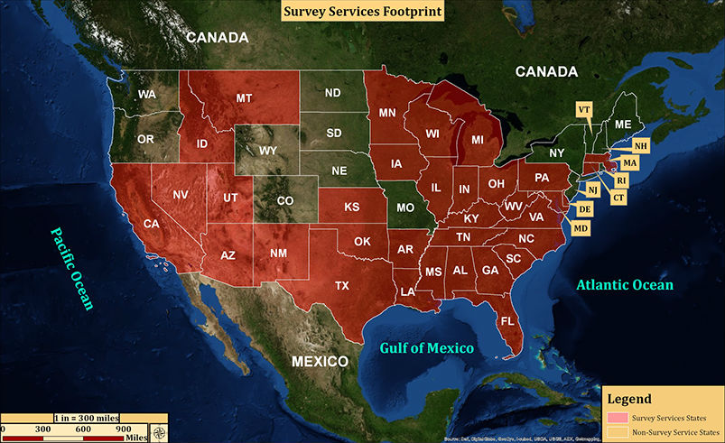
Properties often have considerable problems with regards to improper bounding, miscalculations in past surveys, titles, easements, and natural/environmental issues that can only be revealed via a survey. Many times properties are created from multiple divisions of a larger parcel over the course of years, and the risk of miscalculation increases with every subdivision. An updated survey will determine the most accurate boundaries of the asset by gathering information through observations, measurements in the field, legal research, and data analysis. Survey Services provided include, but are not limited to the following: Aerial mapping, GPS, boundary surveys, physical improvement surveys, sub-division, ALTA-ACSM, and topographic surveys. These services are provided in the 34 states shown below:
© 2014 Jewell Analytics Group | Phone: (704) 953 - 0885 | 5 Mayflower Drive - Scarborough, ME 04074